

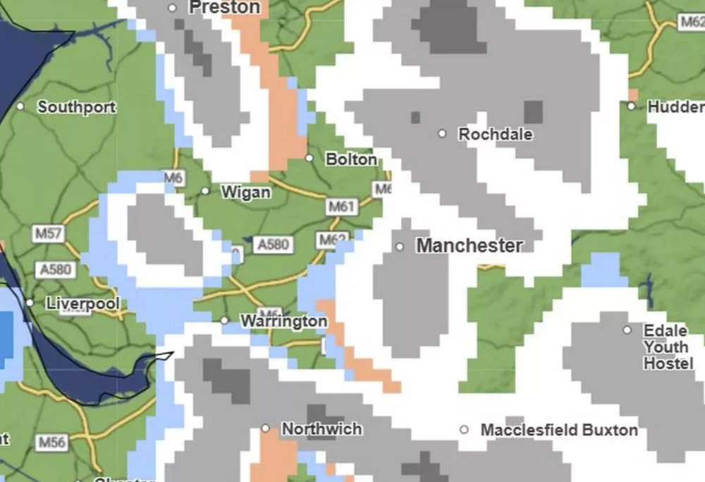
A severe weather warning is now in place for all parts of Greater Manchester, as the Met Office updates its forecast to include the entire region in its snow and ice alert.
The yellow warning will take effect from 3pm on Sunday 4 January and last until midday on Monday 5 January. The updated alert follows a previous warning that only covered southern and eastern parts of Greater Manchester.
The Met Office is warning of potential travel disruption caused by snow showers and icy surfaces. Drivers and pedestrians are urged to exercise caution.
A Met Office spokesperson said:
Snow showers are expected to push further inland across Wales, parts of northwest England, the West Midlands and southwest England during Sunday evening. Along windward coasts, some rain and sleet is likely, but inland showers will fall as snow.
Whilst not all locations in the warning area will see snow, 1 to 3cm could develop in many places by Monday morning, with the potential for 5 to 8cm to build up in a few locations, particularly across inland and higher parts of Wales. Icy stretches are likely to form widely.
All boroughs of Greater Manchester are forecast to see at least some snow from Sunday afternoon into the evening. Overnight temperatures are expected to plunge to around -7°C, with conditions unlikely to rise above freezing on Monday.
 Police issue dispersal order across Greater Manchester to prevent dangerous car meets
 Salford community rallies to support family of 19-year-old Harley McNulty
 United Utilities urges residents to protect pipes ahead of freezing weekend
Comments
Add a comment