

Greater Manchester faces torrential conditions with flood warnings and possible gales as weekend storm threat looms
Manchester is bracing for up to 17 hours of continuous rainfall as stormy weather sweeps across northern England, according to the latest forecast from the Met Office.
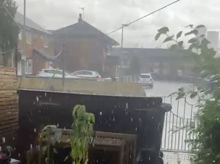
The region was struck by a heavy thunderstorm this afternoon, Thursday, 11 September, with thunder and lightning reported in parts of Greater Manchester and persistent showers expected to continue overnight. Wind speeds are also forecast to gradually ease, but conditions will remain unsettled through to the weekend.
A yellow weather warning for wind has been issued for large parts of the UK, coming into effect from 8pm on Sunday, 14 September, and lasting until 6pm on Monday,15 September. Forecasters say gusty conditions could bring disruption to southern and western regions, with coastal areas at particular risk of gales.
Although Friday is expected to bring more heavy downpours and a risk of thunder, meteorologists believe there will be more dry spells compared to Thursday. Temperatures are expected to reach up to 18°C.
Multiple flood warnings remain in place across the North West, with the Environment Agency issuing alerts for areas including Warrington, Fleetwood, West Kirby and Morecambe Bay.
The Met Office has not ruled out the arrival of the UK’s first named storm of the year, Storm Amy, as low-pressure systems build over the weekend. A spokesperson said that the country should expect “more widely wet” conditions by Sunday, with strong winds and further disruption possible depending on the storm's path.
As the region continues to experience extreme and unpredictable weather patterns, residents are urged to monitor local forecasts and prepare for potential delays to travel and outdoor plans.
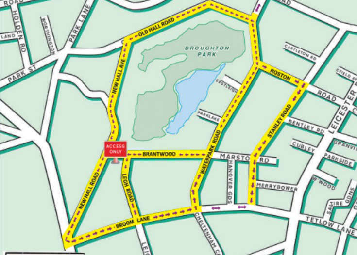 Road closures in place as Purim celebrations begin
 University of Salford apprentice named policing apprentice of the year
 Two arrested after Salford carjacking outside Black Friars store
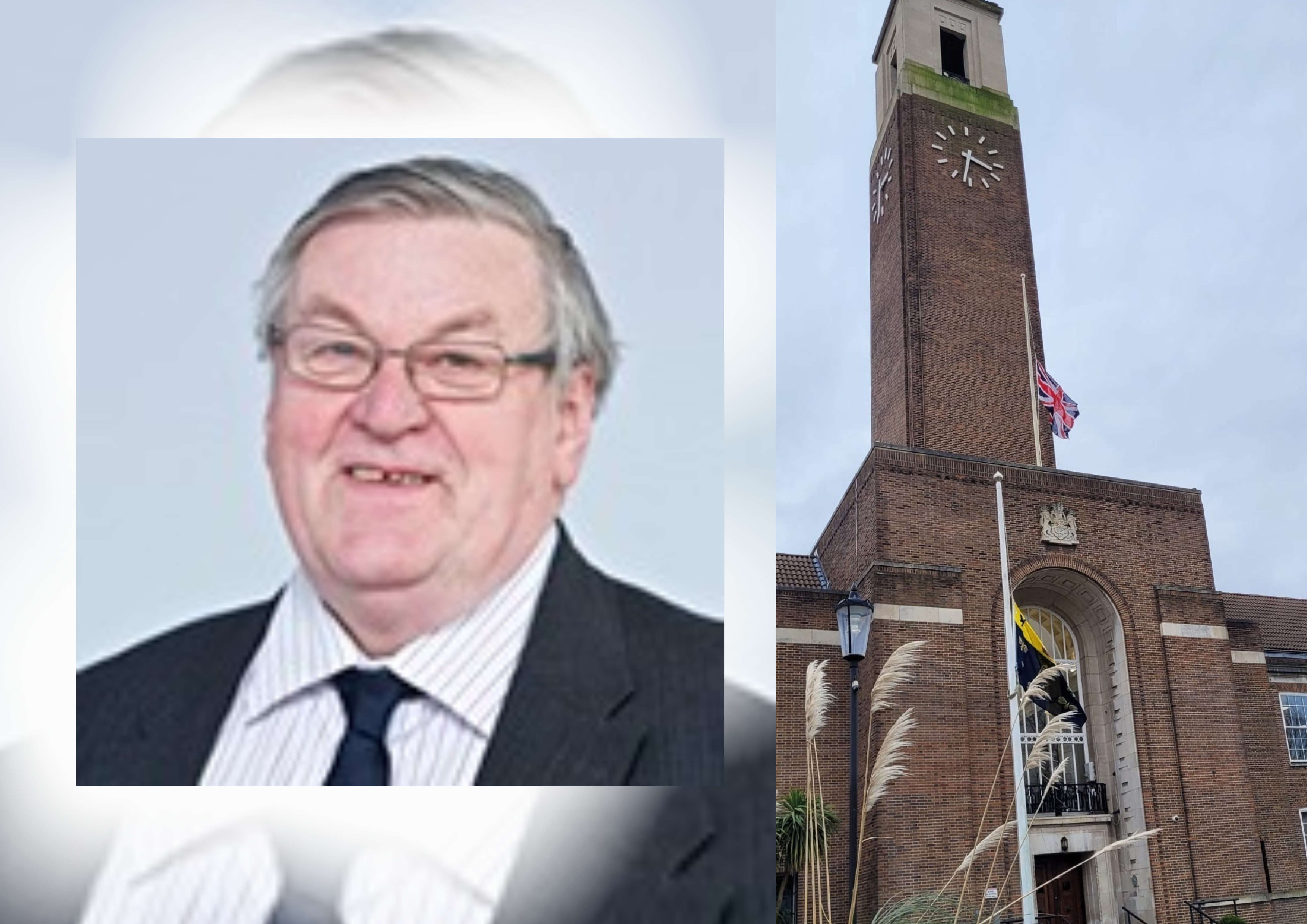 Salford City Council announces death of Councillor David Lancaster MBE
Comments
Add a comment